About ((Kapisa Districts Maps) د کاپیسا ولایت او ولسوالیو نقشه ): You can read short details of the book above. If You want to get the book ((Kapisa Districts Maps) د کاپیسا ولایت او ولسوالیو نقشه ), than just click on DOWNLOAD Now Bottom, wait and the download will start to your Mobile/PC.
Quotes
Kapisa; A verdant province on the slopes of the Hindu Kush mountains
The province of Kapisa or Kapis means the garden of God; This green and lush land is located at the foot of the Hindu Kush mountain range.
Kapisa; A verdant province on the slopes of the Hindu Kush mountains
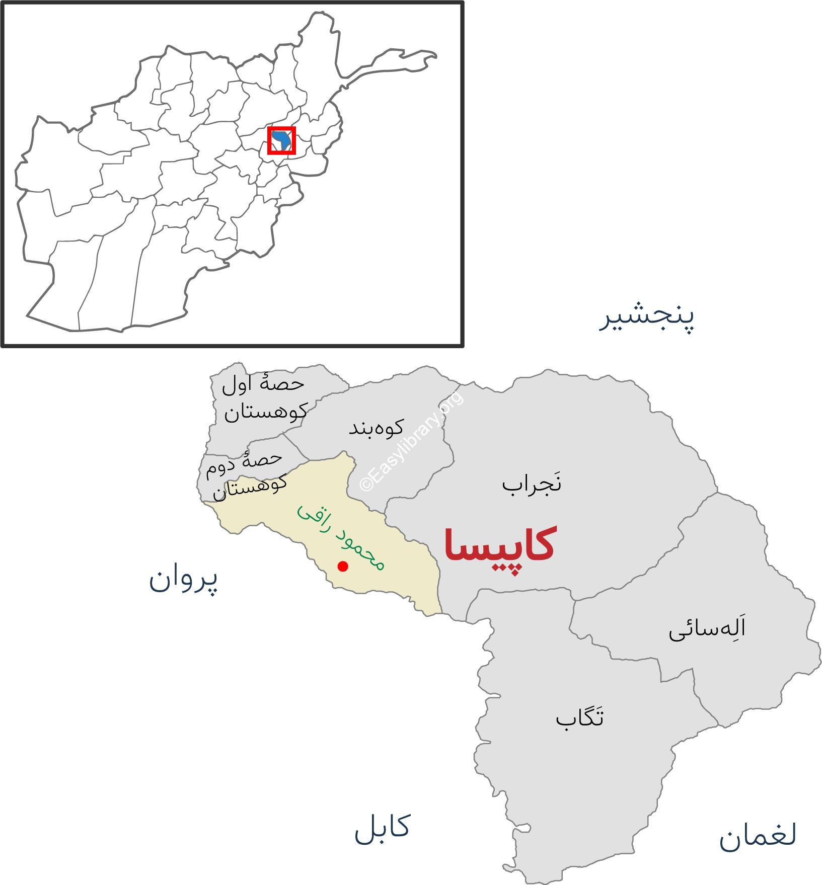
Kapisa province is one of the beautiful provinces of Afghanistan, which is located in the central part of the country and is bordered by Panjshir province in the north, Parwan province in the west, and Laghman and Kabul provinces in the south.
This province is the smallest province of Afghanistan with an area of 1,842 square kilometers. Kapisa has more than 488 thousand people, most of whom are Tajiks. Dari, Pashto, Pesha and Prachi are among the languages spoken in Kapisa province.
According to the climate of this province, which has a rainfall of about 300 to 400 mm, agriculture and horticulture are particularly prosperous. For this reason, most of the people of this green and beautiful province are farmers and gardeners.
Kapisa; A verdant province on the slopes of the Hindu Kush mountains
The main products of this province are wheat, barley, corn, beans, soybeans, pomegranates, grapes, pine nuts, berries, apples, and balang, whose pomegranates and grapes are exported to other countries and are famous worldwide.
Kapisa is very popular with the people of Afghanistan due to its mountainous geography, abundant water, proximity to Kabul, recreational and green places.
Sanjan, Khamzargar, Rigrovan, Bolghin, and Shirkhankhel are among the famous mountains, and Khajaje River, Razaq River, Rigrovan River, and Afghan River are among the major rivers of this province.
Kapisa is one of the ancient regions of Afghanistan, which was the summer capital of Kanishka in ancient Ariana 620 years ago, and present-day India, Bangladesh and Pakistan were administered from the center of Kapisa.
There are many historical monuments in Kapisa; The area known as Khamzargar, Burj Abdullah and Rigarvan are among the historical monuments of this province.
At the end of 2018, Afghan archaeologists in cooperation with the local administration of Kapisa were able to discover for the first time after 45 years the ancient works of two lions with their tongues out of their throats carved on both sides of the stone steps in the Khamzargar area. Kapisa; A verdant province on the slopes of the Hindu Kush mountains
From Koh Band to Mahmoud Raqi
Kapisa province has seven districts, namely Ele Sai, Tagab, the first part of Kohistan, the second part of Kohistan, Koh Band, Mahmoud Raqi and Najarab.
Ale Sai: It is one of the eastern districts of Kapisa province, which is bordered by Najrab from the north, Tagab from the south and west, and Panjshir province from the east. This district has more than 42 thousand people.
Afghanistan JOBS , Download Also this book , Articles ,+Publish your Books


Reviews
There are no reviews yet.